MOUNTAIN VIEW COUNTY - Attendees posed a number of questions to Mountain View County's administration during a recent virtual open house for the proposed new Sundre Airport concept plan, say officials.
“Answers to questions focused on how the proposed concept plan and land use bylaw amendments will affect landowners within the outer surface, the process on inserting the concept plan in the South McDougal Flats area structure plan, and potential impacts of airport growth on Coyote Creek,” Margaretha Bloem, director for planning and development services for the county, told the Albertan.
An in-person open house for the plan was scheduled for the Royal Canadian Legion in Sundre on May 26. Comments on the plan will be collected until June 10.
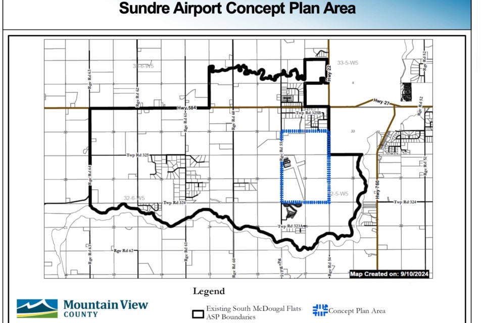
The county-owned airport is located about one kilometre southwest of Sundre with access from Range Road (Rge. Rd.) 55.
The South McDougal Flats area structure plan (adopted in 2024) outlines the need for a separate concept plan. Council approved the development of the plan in August 2024 and appointed the steering committee that is overseeing the project.
Subject to the public hearing process, the concept plan is being created to provide guidance on the airport’s future growth while identifying compatible surrounding land uses and developments, she said.
The plan encompasses six quarter-sections: one surrounding the airport’s hangars and runways (NW 29-32-5-5), one containing a portion of a runway but otherwise undeveloped, two remaining bare land, and two that are being used for aggregate extraction.
The plan outlines draft policies for each of the six quarter-sections, and outlines objectives and goals of the plan.
For the NW 29-32-5-5 section, the plan states, in part, that, “Future development within the airport may have individuals water wells and private sewage that comply with provincial regulations, agricultural uses that remain compatible with airport are encouraged to continue, and commercial alternative/renewable energy projects are not supports.”
The plan’s overall objectives include establishing “a long-term vision of the development of the concept plan area that will support future economic opportunities, while also complimenting the surrounding community” and “to establish policies to protect the lands surrounding the airport to allow for sure airport expansion and the opportunity for aggregate extraction as interim land use.”
Goals of the plan include “providing guidance on how the Sundre Airport and adjacent lands within the concept plan can be developed in the future to support economic opportunities as well as compatible recreation uses” and “encourage high-end business with the opportunity to for both aviation related and non-aviation related development.”
The plan also includes a section highlighting opportunities that can be considered within the concept plan area, including commercial and industrial opportunities, flight school training, recreational uses, emergency services, aircraft and hangars, agricultural uses, aggregate extraction, and low impact recreation.
The complete draft plan is available for viewing the county’s website.
If eventually adopted by council through motion, the concept plan would be incorporated into the South McDougal Flats area structure plan.


