RODANTHE, N.C. (AP) — Strong winds and waves battered Nantucket and Martha’s Vineyard and dangerous rip currents threatened from the Carolinas to New England as Hurricane Erin made its way farther out to sea.
The storm was forecast to cause possible coastal flooding into the weekend along the East Coast but was also expected to gradually lose strength. The National Hurricane Center in Miami reported early Friday that Erin had weakened to a Category 1 hurricane, with maximum sustained winds of 90 mph (150 kph), and was located about 425 miles (680 kilometers) south-southwest of Halifax, Novia Scotia.
Despite being twice the size of an average hurricane, Erin so far has managed to thread the needle through the Atlantic between the East Coast and several island nations, limiting its destructiveness.
Massachusetts-based meteorologist Caitlyn Mench said Friday that Erin's high wind field caused it to be felt widely along the East Coast: “On a positive note, it passed all offshore," she said, of the New England area, which experienced some minor coastal flooding due to the storm.
Nantucket's airport recorded winds of up to 45 mph (72 kph) overnight into Friday. The Massachusetts Bay Transportation Authority announced Friday that it was canceling ferry service to and from the Boston area cities of Lynn, Quincy, and Winthrop. Several oceanside beaches along Cape Cod’s National Seashore also closed to swimmers and other recreation due to high surf and rip currents.
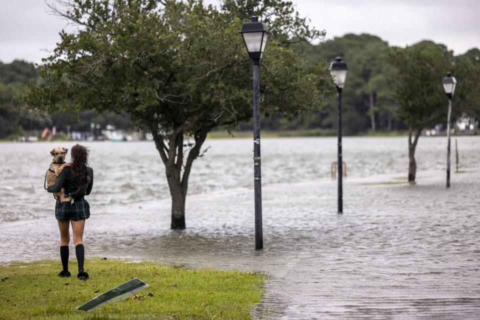
On North Carolina’s Outer Banks, waves breached dunes in the town of Kill Devil Hills on Thursday evening, and water and sand pooled on Highway 12.
Although damage assessments were still underway, the low-lying islands appeared to have dodged widespread trouble.
A tropical storm warning was lifted for Bermuda, where residents and tourists had been told to stay out of the water through Friday. Warnings along the coasts of North Carolina and Virginia were also discontinued.
The National Weather Service issued coastal flood warnings for places as far north as the Mid-Atlantic and New England coasts, saying that some roads could be made impassable.
On Thursday night, local news outlets reported that firefighters rescued more than 50 people from cars, restaurants and bars after tidal flooding in Margate City, New Jersey.
Beaches were closed to swimming Thursday in New York City, but more than a dozen surfers still rode waves at Rockaway Beach in Queens. Scott Klossner, who lives nearby, said conditions were great for experienced surfers.
“You wait all year round for these kinds of waves. It’s challenging, really hard to stay in one place, because there’s a heavy, heavy, heavy rip,” he said. “But this is what surfers want — a hurricane that comes but doesn’t destroy my house? I’ll take that.”
The Outer Banks — essentially sand dunes sticking out of the ocean a few feet above sea level — are vulnerable to erosion. Storm surges can cut through them, washing tons of sand and debris onto roads and sometimes breaking up pavement and creating new inlets.
The dunes and beach took a beating the last two days, but Dare County Manager Bobby Outten said there have been no new inlets with Erin or significant structural damage to homes or businesses.
“All in all, it’s not as bad as it could have been,” Outten said. “Hopefully the worst of it is behind us.”
On Jennette’s Pier in Nags Head, where sustained winds reached 45 mph (72 kph), dozens of onlookers snapped photos of the huge waves crashing into the structure amid driving rain.
“This is nature at her best,” Nags Head resident David Alan Harvey said. “I love this. I love these storms.”
Erin has fluctuated in intensity since forming nearly a week ago but remained unusually large, stretching across more than 600 miles (965 kilometers).
So-called Cape Verde hurricanes like Erin, which originate near those islands off the west coast of Africa, cross thousands of miles of warm ocean and are some of the most dangerous to North America.
___
Seewer reported from Toledo, Ohio. Associated Press journalists Tammy Webber in Fenton, Michigan; Jeffrey Collins in Columbia, South Carolina; Kathy McCormack in Concord, New Hampshire; Julie Walker in New York; and Leah Willingham in Boston contributed.
___ The Associated Press’ climate and environmental coverage receives financial support from multiple private foundations. AP is solely responsible for all content. Find AP’s standards for working with philanthropies, a list of supporters and funded coverage areas at AP.org.
Allen G. Breed And John Seewer, The Associated Press


