MIAMI (AP) — Hurricane Erin began pelting part of the Caribbean with rain and wind Monday before it's expected to churn up dangerous surf and rip currents along the U.S. East Coast this week.
Evacuations were being ordered on a few islands along North Carolina’s Outer Banks even though the storm is unlikely to make direct landfall. Authorities warned that some roads could be swamped by waves of 15 feet (4.6 meters).
The monster storm intensified to a Category 4 with 140 mph (225 kph) maximum sustained winds early Monday while it started to lash the Turks and Caicos Islands and the southeast Bahamas, according to the U.S. National Hurricane Center in Miami.
Forecasters are confident that Erin will turn northeast and away from the eastern U.S., but it's still expected to produce dangerous waves and rip currents and could bring tropical force winds to North Carolina coast, said Dave Roberts of the National Hurricane Center.
Evacuations were ordered beginning Monday on Hatteras Island and Ocracoke Island on the Outer Banks, coming at the height of tourist season on the thin stretch of low-lying barrier islands that juts far into the Atlantic Ocean.
Coastal flooding was expected to begin Tuesday and continue through Thursday.
There are concerns that several days of heavy surf, high winds and waves could wash out parts of the main highway running along the barrier islands, the National Weather Service said. Some routes could be impassible for several days, authorities warned.
But there were no signs of panic on Hatteras Island, said Angela Tawes, a co-owner of Conner’s Supermarket. “It’s so beautiful outside. It’s hard for people to feel like there’s a hurricane coming when it’s so gorgeous,” she said.
Erin, the year’s first Atlantic hurricane, reached a dangerous Category 5 status Saturday with 160 mph (260 kph) winds before weakening. It is expected to remain a large, major hurricane into midweek.
“You’re dealing with a major hurricane. The intensity is fluctuating. It’s a dangerous hurricane in any event,” the hurricane center's Richard Pasch said.
Early Monday, the storm was located about 110 miles (180 kilometers) north of Grand Turk Island and about 880 miles (1,400 kilometers) south-southeast of Cape Hatteras, North Carolina.
Tropical storm warnings were in effect for the southeast Bahamas and the Turks and Caicos Islands, the hurricane center said.
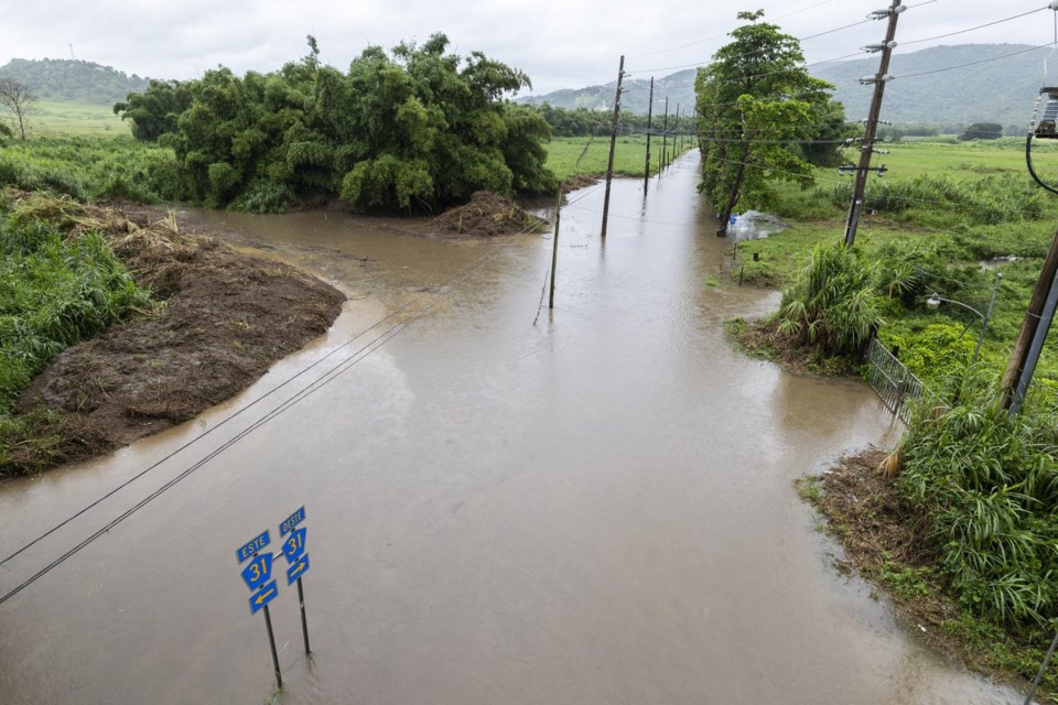
Erin’s outer bands hit parts of Puerto Rico and the Virgin Islands with heavy rains and tropical-storm winds on Sunday.
Scientists have linked the rapid intensification of hurricanes in the Atlantic to climate change. Global warming is causing the atmosphere to hold more water vapor and is spiking ocean temperatures, and warmer waters give hurricanes fuel to unleash more rain and strengthen more quickly.
The Associated Press


