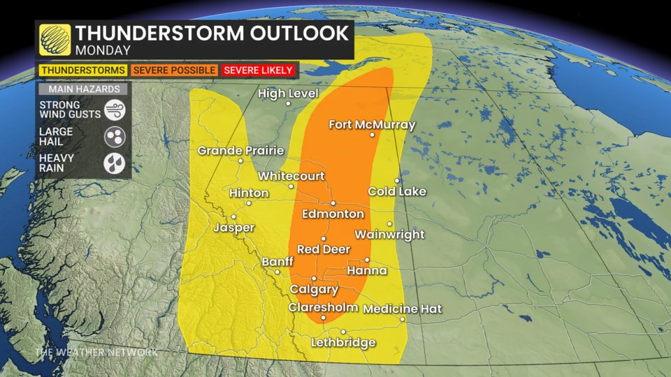
A severe weather setup is taking shape across Alberta late Monday, with central parts of the province—particularly the area between Edmonton and Calgary—expected to see the most intense storm activity. Cochrane, Airdrie and Rocky View could all see thunderstorms late Monday.
A strong line of thunderstorms is forecast to develop along a cold front sweeping across the province, bringing threats of large hail, heavy rainfall and damaging wind gusts.
According to forecasters, the most intense storms could produce wind gusts up to 100 km/h and loonie-sized hail. While confidence remains lower regarding the overall severity, there is high confidence that the bulk of thunderstorm activity will occur between 4 and 8 p.m. local time.
Rain is expected to follow the storms into the evening, particularly across central and mid-Alberta, with precipitation also reaching parts of eastern British Columbia.
Temperatures are forecast to trend above seasonal averages through the final week of May and into early June. While no major storm systems are currently on the radar, occasional showers and thunderstorms are expected—although overall conditions are expected to be drier than normal.
Residents are advised to stay alert and monitor Environment Canada alerts and warnings as conditions evolve.


